How Do Marine Navigation Apps Help Sailors Avoid Shallow Waters?
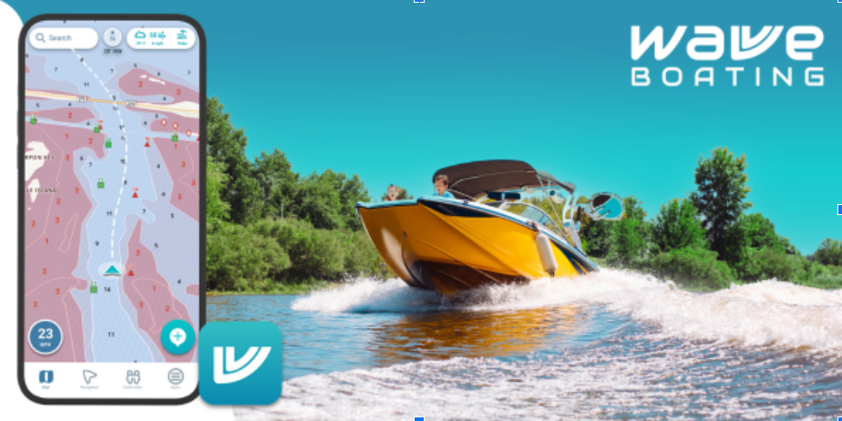
Sailing safely requires more than just skill at the helm—it depends on accurate information and the right tools. For modern mariners, best marine navigation apps have become indispensable in reducing risks like running aground. These apps provide real-time depth data, tide forecasts, and digital charts that pinpoint shallow areas, giving sailors an edge over traditional methods. Alongside tools like NOAA nautical charts, navigation apps ensure sailors are prepared to identify and avoid underwater dangers before they pose a serious threat.
Why Shallow Waters Are Dangerous?
Shallow waters may appear calm and harmless, but they remain one of the most common causes of accidents at sea. Running aground can damage a vessel’s hull, jeopardise crew safety, and even require costly rescue operations. Unlike rocks or buoys that can be spotted visually, shallow patches often lurk beneath the surface, especially in tidal zones or unfamiliar harbours. This makes digital navigation aids vital for identifying and avoiding hidden hazards.
How Navigation Apps Keep Sailors Safe?
- Access to Updated Digital Charts
Unlike paper charts, which may be outdated, marine navigation apps continuously integrate updates from official hydrographic offices. This means that depth contours, channels, and hazard markers are always up to date. Sailors can plan routes with confidence, knowing they are referencing the latest available data. - Real-Time GPS Positioning
By combining GPS tracking with chart overlays, sailors can see exactly where they are relative to shallow zones. This is especially useful when navigating narrow channels or approaching unfamiliar coastlines. The ability to track a live position helps reduce human error and keeps vessels clear of risky areas. - Tide and Current Predictions
Many groundings occur because sailors miscalculate the effects of tides. Navigation apps often include tidal forecasts and current models, allowing mariners to adjust their timing and avoid shallow passages at low tide. A rising tide can create safe passage, while an ebbing tide can expose previously submerged hazards. - Custom Depth Alerts
Some apps allow sailors to set alarms for specific depth thresholds. For example, if a vessel requires a minimum draft of two meters, the app can alert the crew when approaching waters shallower than that. This proactive warning system minimises last-minute maneuvering. - Crowdsourced Hazard Reports
Many marine navigation apps incorporate community features that allow sailors to share observations about shallow patches, sandbars, or uncharted obstacles. These real-world reports add an extra layer of protection, as fellow mariners contribute to a continuously updated hazard database.
See also: About Qy-45y3-Q8w32 Model: the Future of Smart Home Technology
Practical Scenarios Where Apps Prevent Groundings
- Harbour Entry: Entering an unfamiliar harbour at night can be nerve-racking. A navigation app with real-time GPS positioning displays the exact track relative to dredged channels, preventing accidental entry into shallow side channels.
- Coastal Cruising: When sailing close to shorelines with shifting sandbanks, apps highlight updated depth contours, ensuring vessels remain on safe courses.
- Fishing Grounds: Commercial and recreational fishers often navigate in shallow areas. By using an app with depth shading and tide predictions, they can reduce the chance of running aground while maximising fishing opportunities.
Beyond Safety: Confidence and Efficiency
Avoiding shallow waters is not just about preventing damage; it also improves voyage efficiency. Groundings often delay trips, consume extra fuel during detours, and cause stress among crew members. By utilising reliable marine navigation apps, sailors can plan the most direct routes while ensuring safety.
The confidence these tools provide cannot be overstated. With visual warnings, tide forecasts, and real-time depth awareness, crews are more relaxed, better prepared, and free to focus on enjoying the sailing experience rather than constantly worrying about underwater hazards.
Future of Marine Navigation Technology
Marine navigation apps continue to evolve with advanced features. Some now integrate augmented reality, projecting navigation data directly onto a device’s camera view for intuitive hazard avoidance. Others combine artificial intelligence to suggest safer alternative routes based on vessel draft, tidal cycles, and crowdsourced hazard reports.
Integration with onboard sensors is also becoming more common. By linking sonar and depth-sounding equipment with app displays, sailors get a complete picture of their surroundings—blending real-time observations with predictive chart data. This trend is pushing navigation safety to new levels.
Conclusion
For sailors, shallow waters remain a persistent and dangerous challenge. However, technology has shifted the balance in favor of safety. Marine navigation apps combine updated charts, real-time GPS tracking, tide predictions, and hazard alerts to provide an all-in-one defence against groundings. By adopting the best marine navigation apps, mariners not only safeguard their vessels but also sail with greater confidence, efficiency, and peace of mind.